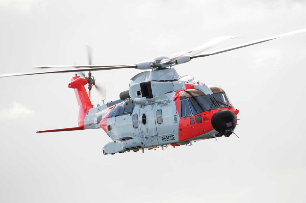
Since its introduction two years ago into the Royal Norwegian Air Force search-and-rescue (SAR) Queen fleet of AW101 aircraft, Artemis has been a valued addition to the sensor array that this fine aircraft boasts.
The mobile phone detection and location technology is as vital as any of the AW101’s new sensor systems and a fundamental leap in SAR capability, allowing operators to spend less time searching and more effort on the rescue.

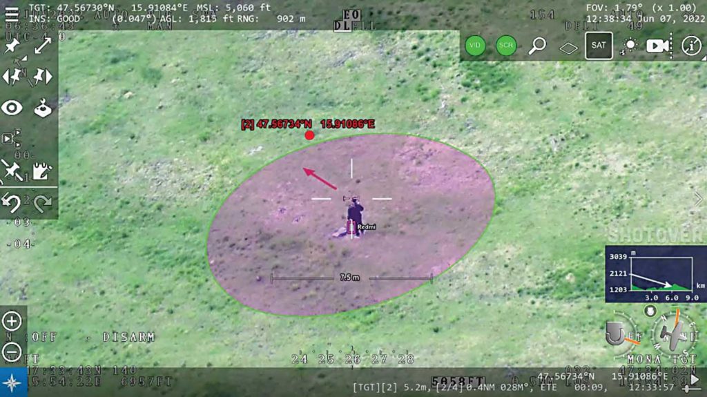
“We recently had a mission in icing conditions to find missing people in the mountains,” said Col. Tord Aslaksen, commander of the Royal Norwegian Air Force SAR helicopter wing in Norway. “While we couldn’t land due to the terrain and weather conditions, we could pick them up on the Artemis mobile phone detection and location system. The coordinates were so accurate that when we handed these over to the team on the ground, they were able to find them in 15 minutes.”
In the months since the first Norwegian helicopters entered service, Artemis has saved lives and offered communication to the ground, in one instance, communicating via text to determine all were OK and not in need of rescue.

Artemis is a product of Smith Myers, a company based near Bedford, U.K. — this year, celebrating 35 years in cellular technology design. Founded in 1987 by Peter Myers and Tony Smith, design engineers with expertise in high-speed communication and military applications, the company prides itself on a workforce of test and design engineers drawn from telecommunications and engineering giants, such as British Aerospace and Marconi Instruments.
“We’re not entrepreneurs or academics,” Myers said. “We have a long history in the design and production of test and measurement equipment for the cellular network industry.”
With Artemis, Smith Myers has developed cellular signal location technology for the challenging airborne SAR environment.
Unlike traditional direction-finding sensors that rely on complex antenna arrays and multiple aerials on an airframe, Artemis uses only two antennas and its distance estimation methods, employing an auto triangulation algorithm to accurately derive the latitude and longitude of a mobile phone location.
If a phone is powered on within a search or disaster area, Artemis’ software defined radio and cellular protocol stacks can utilize GSM (Global System for Mobile Communications), 3G, or 4G signaling to locate the device within meters with a single transceiver.
“When the system connects with the phone, we have the aircraft’s GPS position, so we can measure the distance to the phone and do our own triangulation,” Myers explained. “We can perform multiple measurements every second. We have a range of up to 35 kilometers [22 miles], and at that distance, we can locate a phone within 100 meters [328 feet].”
In natural disasters where cellular coverage may be unavailable or compromised, Artemis “works even better because the phone is looking for us,” he noted. “In a forest fire, for example, where the cellular network is out, we can fly over all the active phones and they will register with Artemis. We can send an automated text message advising those people which direction the fire is coming from, or we can ask if anyone needs medical assistance and talk directly with that person. We can also coordinate with ground assets via text or voice calls. If the phone is on, we can locate it.”
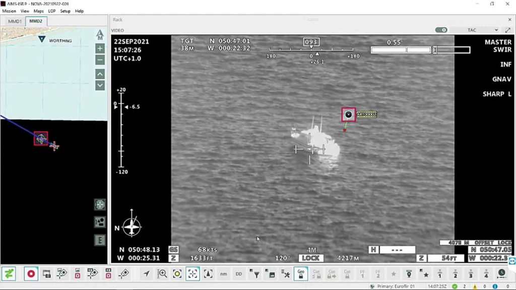
Artemis can be employed as a standalone system or easily integrated with other sensors into an aircraft mission system, such as Carte Nav’s AIMS-ISR, Shotover Gear, and many others, enhancing its performance in low visibility or instrument meteorological conditions.
“With the phone details from a network operator, we can look for that phone, reject all others, calculate its position, and then the camera can be slewed to look there,” Myers said. “We add tremendous value to any existing platform with EO/IR cameras. Night missions can be undertaken with a high probability of a rapid positive outcome.”
Even without other sensors, Artemis can provide exceptional signal location. “It has embedded mapping. You can drive it from a phone using a web browser if you have Wi-Fi in the cabin,” he noted.
Smith Myers recently released details of its Artemis simulator, allowing crews to run missions without leaving the ground. The system can also play back previously flown missions for review and training.
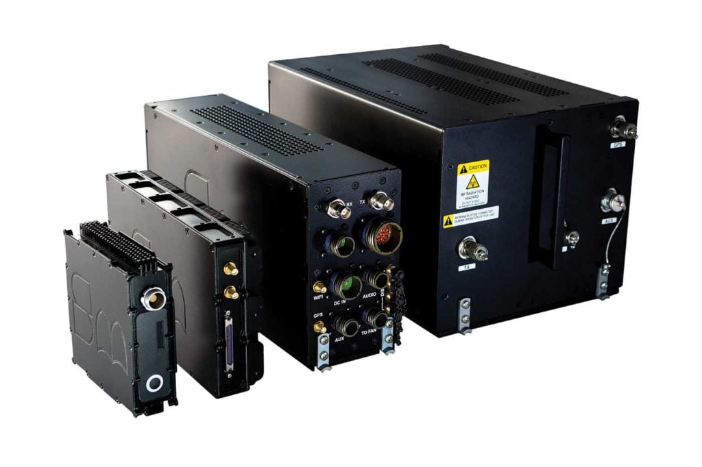
Smith Myers designs and manufacturers all products — hardware and software — in-house and has developed Artemis for fixed-wing, rotary-wing, and unmanned platforms in configurations ranging from 15.5 kilograms (34 pounds) to 560 grams (1.2 lb) — the latter has been fully integrated into the ECHO payload on the Teledyne FLIR Sky Ranger R70 UAS.
Artemis has the option of receivers for automatic identification system (AIS) and/or the humanitarian SAR COSPAS/SARSAT. It has been rigorously tested for all environmental extremes and survived brutal DO160/MilStd 810 qualification testing, including extensive EMC testing.
The value Artemis offers to SAR, disaster relief, and other operations was well understood even before Leonardo selected the system for the AW101 SAR platform. But in 2018, the Royal Aeronautical Society recognized the strength of that partnership with its team silver medal award.