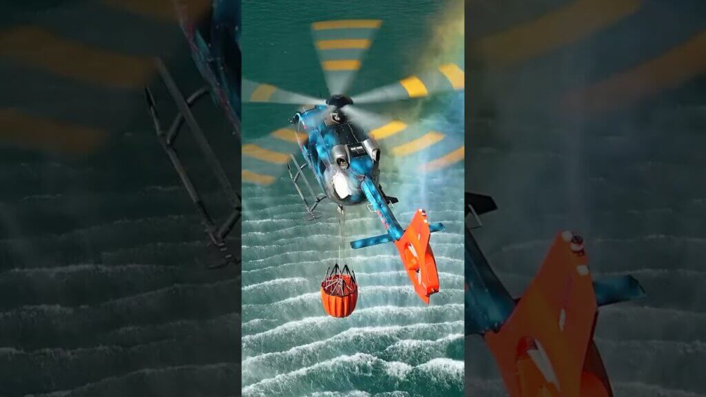
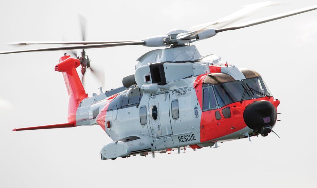
In 2020, when Leonardo delivered the first of 16 new AW101 search-and-rescue (SAR) helicopters to the Royal Norwegian Air Force, most of the media attention focused on the improved engine, fully integrated avionics and mission system, AESA radar, electro-optical surveillance system, obstacle proximity LiDAR, four-axis digital automatic flight control system, and other enhanced features.
Far less was written about a modest 15.5-kilogram (34 pound) box called Artemis.
That mobile phone detection and location technology, however, could prove to be as vital as any of the AW101’s new sensor systems and a fundamental leap in SAR capability, allowing operators to spend less time searching and more effort on the rescue, by quickly locating and communicating with someone in distress.
In the months since the first Norwegian helicopters entered service, Artemis has helped locate people reported missing, zeroing in on their phone signal and, in one instance, communicating via text to determine all were OK and not in need of rescue.
Artemis is a product of Smith Myers, a company based near Bedford, U.K., marking 35 years in cellular technology development. Founded in 1987 by Peter Myers and Tony Smith, design engineers with expertise in high-speed communication and military applications, the company prides itself on a workforce of test and design engineers drawn from the likes of telecommunications and engineering giants, such as British Aerospace and Marconi.
“We’re not entrepreneurs or academics,” said Myers, the company’s joint managing director. “We have a long history in design and production of test and measurement equipment for the cellular network industry — many years of technical experience goes into our products.”
With Artemis, Smith Myers has developed cellular signal location technology for the challenging airborne SAR environment.
“Artemis was designed specifically for this task,” Myers said. “We’re not taking someone else’s receivers or software and repurposing it.”
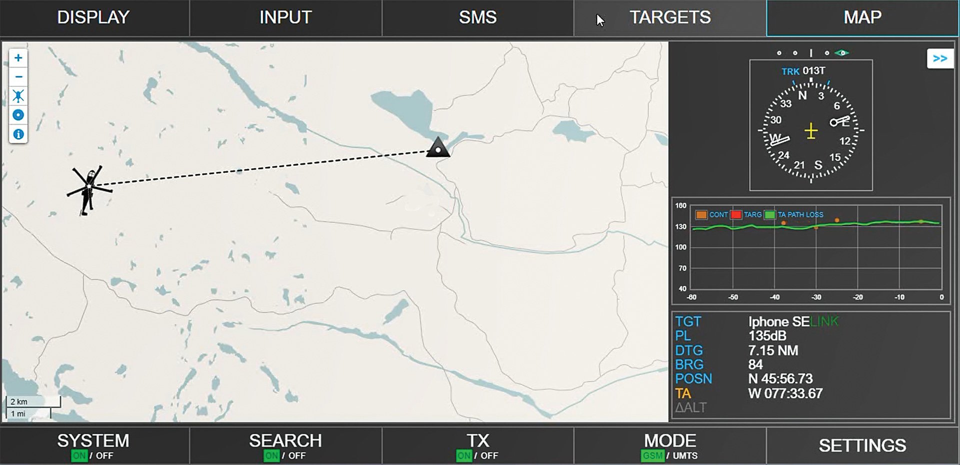
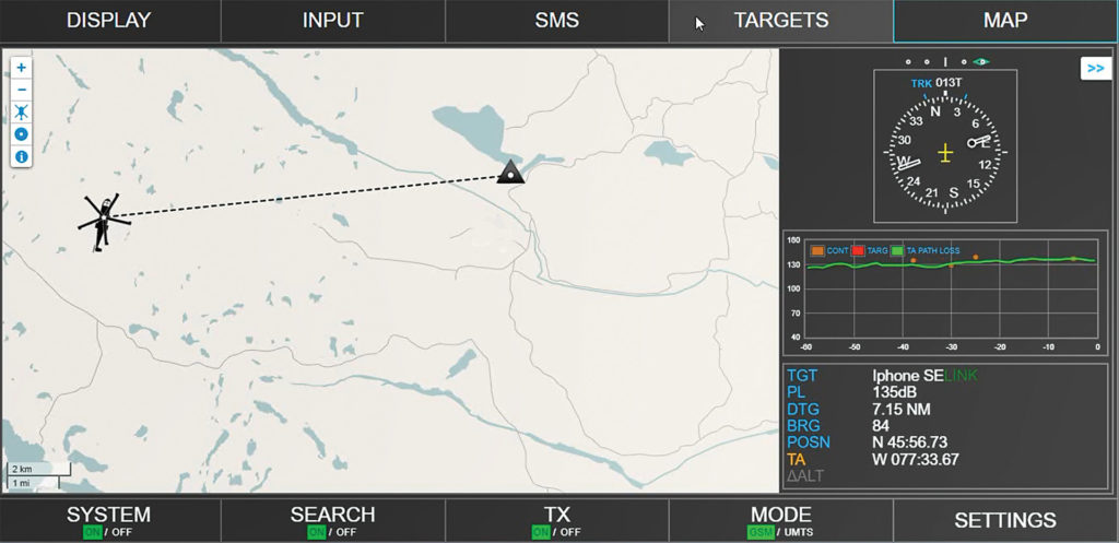
Unlike traditional direction-finding sensors that rely on complex antenna arrays and multiple aerials on an airframe, Artemis uses only two antennas and its distance estimation methods, employing an auto triangulation algorithm to accurately derive the latitude and longitude of a mobile phone location.
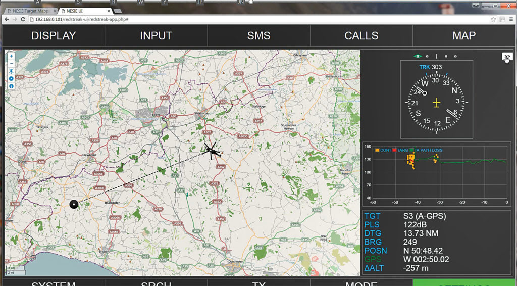
“When the aircraft connects with the phone, we know where the aircraft is with GPS, so we measure the distance and do our own triangulation,” Myers explained. “We are performing multiple measurements every second. As the aircraft is moving, we get finer and finer resolution on the location. We have a range of up to 35 kilometers [22 miles] and at that distance, we can locate a phone within 100 meters [328 feet].”
In natural disasters where cellular coverage may be unavailable or compromised, Artemis “works even better because the phone is looking for us,” he noted. “In a forest fire, for example, where the cellular network is out, when we fly over all the active phones, they will register with Artemis. We can send an automated text message advising those people which direction the fire is coming from and which way to flee, or we can ask if anyone needs medical assistance and talk directly with that person. If the phone is on, we can locate it.”
Artemis can be employed as a standalone system or easily integrated with other sensors into an aircraft mission system, such as Carte Nav’s AIMS-ISR, enhancing its performance in low visibility or instrument meteorological conditions.
“They read the latitude and longitude from us, and then they can steer the aircraft camera to look at that position,” Myers said. “With the phone details from a network operator, we can look for that phone, reject all others, calculate its position, and then the camera can be slewed to look there. We add tremendous value to any existing platform with EO/IR cameras.”
Even without other sensors, Artemis can provide exceptional signal location. “It has embedded mapping. You can drive it from a phone using a web browser if you have Wi-Fi,” he noted.
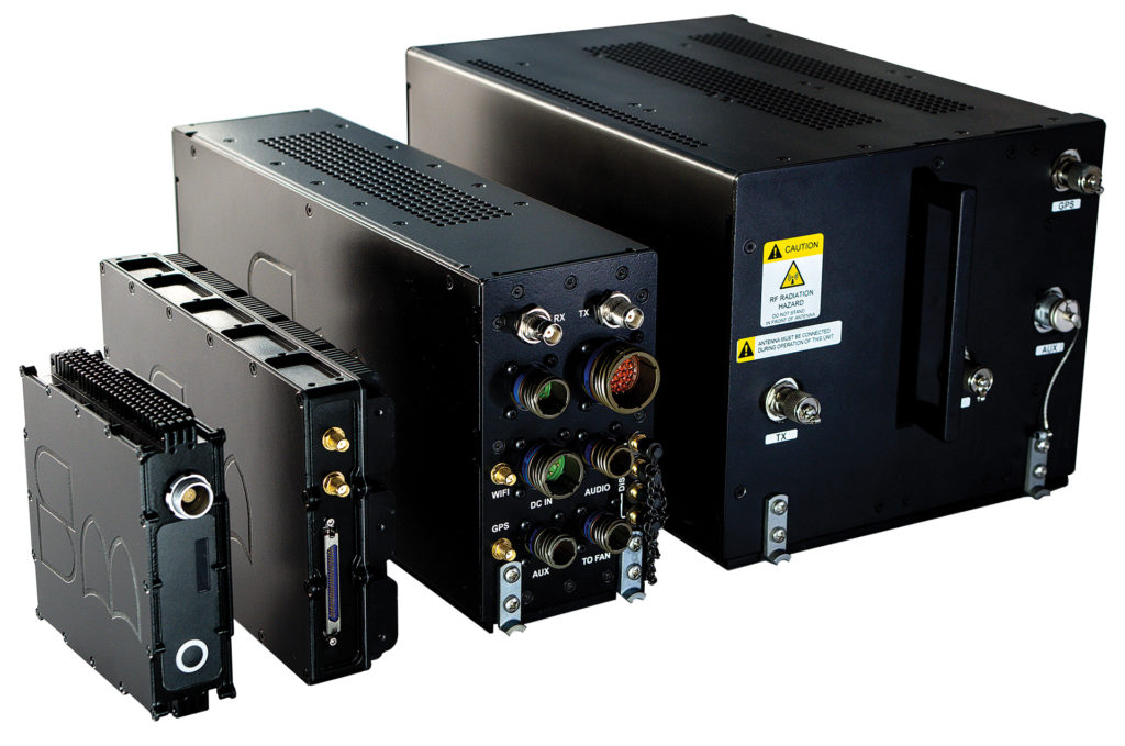
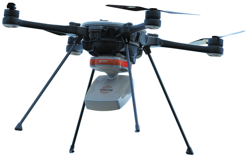
Smith Myers designs and manufacturers all products — hardware and software — in-house and has developed Artemis for fixed-wing, rotary-wing, and unmanned platforms in configurations ranging from 15.5 kg (34 lb.) to 560 grams (1.2 lb.) — the latter has been fully integrated into the ECHO payload on the Teledyne FLIR Sky Ranger R70 UAS.
Artemis has the option of receivers for automatic identification system (AIS) and/or the humanitarian search and rescue COSPAS/SARSAT. It has been rigorously tested for all environmental extremes and survived extensive DO160/military standard 810 qualification testing.
The value Artemis offers to SAR, disaster relief, and other operations was well understood even before Leonardo selected the system for the AW101 SAR platform. But in 2018, the Royal Aeronautical Society recognized the strength of that partnership with its team silver medal award. “That was quite an honor,” Myers said.